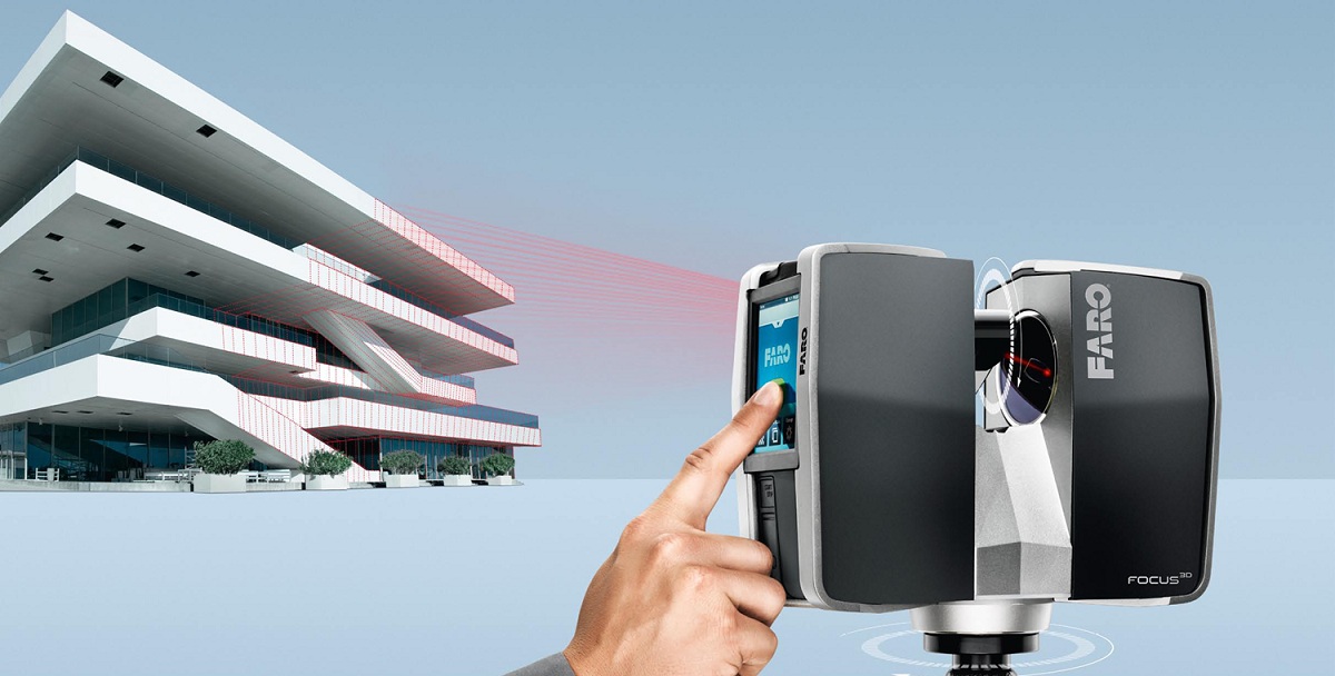
This image taken from the FARO web site illustrates the basics of laser scanning. The scanner sends out a laser beam and when the beam hits a surface it bounces back to the scanner. The scanner records the distance the laser traveled before hitting an object and logs this information to a point in space.
Selective sections from GSA BIM Guide Series 03 – BIM Guide For 3D Imaging
The benefits of determining the spatial environment and as-built conditions have played a key role in reducing costs and delivering a higher quality engineering effort. 3D imaging has also become more prevalent in the architectural/engineering/construction (AEC) industry in pursuit of similar results.
Applications include: documenting historic structures and architectural features, identifying construction discrepancies of aging buildings, determining above ceiling conditions prior to the construction phase, and as-built conditions of entire federal campuses.
3D imaging refers to the practice of using 3D imaging systems to measure or to capture existing conditions in the built or natural environment. 3D imaging systems are instruments that are used to rapidly measure (typically on the order of thousands of measurements per second or faster) the range and bearing to and/or the 3D coordinates of points on an object or within a region of interest… Most current instruments use light in the visible to near infrared spectrum. Examples of 3D imaging systems are laser scanners [also known as laser radars, LADARs (laser detection and ranging), or LiDARS (light detection and ranging)], triangulation-based systems such as those using pattern projectors or lasers, and other systems based on interferometry…
Measurements from 3D imaging systems are made without physical contact between the instrument and the object, and the surfaces of objects to be measured do not require any special surface finish (although specular surfaces such as mirrors or highly reflective materials are problematic). The maximum ranges of 3D imaging systems vary from under 1 m to over a kilometer (several feet to over half a mile), and measurement errors vary from sub-millimeter level to centimeter level (thousandths of an inch to tenths of inches) – with greater errors more often associated with the longer range instruments….
For architectural, engineering, construction (AEC) applications, either a pulsed time-of-flight (TOF) or phased-based 3D imaging system is typically used to obtain 3D information of a scene. In general, TOF systems have longer maximum ranges (over a kilometer), and phase-based systems have shorter maximum ranges (less than 100 m) and have faster data acquisition rates.
3D imaging systems are line of sight (LOS) instruments (most instruments use light in the visible to near infrared range); therefore, solid objects will cast “shadows” representing regions of missing data along the LOS of the instrument. Therefore, scenes need to be scanned from several positions to capture occluded regions and to minimize missing data. Each scan generates a point cloud, which may consist of millions of data points. The time to acquire the data is dependent on the size of the object or region being measured, field of view of the instrument, point density, desired accuracy, and instrument. …
For further information about this GSA BIM Guide Series 03 – BIM Guide For 3D Imaging visit the National 3D-4D-BIM webpage: http://www.gsa.gov/graphics/pbs/GSA_BIM_Guide_Series_03.pdf
Sheri Blackford is the owner of Lanmar Services. Registered as a Licensed Architect (TX 16753) and Interior Designer in Texas. She is LEED accredited. She has worked internationally in Europe, Africa, North America and the Bahamas. Prior to Lanmar Services she was Project Architect on Schools, Large Resorts, Hotels, Condominiums and Schools. Her current role as owner of Lanmar Services is to manage projects, direct the LiDAR scanning of the buildings and their documentation.
Thanks for helping me learn more about laser scanning and 3D imaging. It’s kind of cool to know that they can measure and capture existing conditions. I’m kind of interested to learn how this is can be developed and the different factors that are taken into account.
I really like it when folks get together and share opinions.
Great blog, keep it up!